Year :
1993
Title :
Geography
Exam :
JAMB Exam
Paper 1 | Objectives
41 - 50 of 50 Questions
| # | Question | Ans |
|---|---|---|
| 41. |
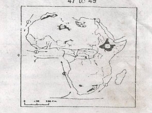 Which of the ocean currents on the map is the Benguela Current? A. 1 B. 2 C. 3 D. 4 |
C |
| 42. |
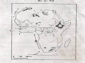 The shaded areas marked Y on the map are A. Salt lakes B. Major groundwater aquifers C. Oil-producing areas D. Regions of large-scale irrigation |
C |
| 43. |
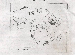 The Ahaggar plateau is the shaded area marked A. P B. Q C. R D. S |
B |
| 44. |
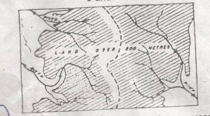 The broken lines in the diagram above represent a A. River capture B. Ridge C. Watershed D. Rift valley |
C |
| 45. |
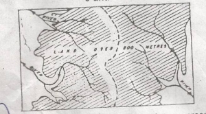 The main work of the rivers in the shaded area is likely to be A. Terracing B. Lateral Erosion C. Deposition D. Down-cutting |
D |
| 46. |
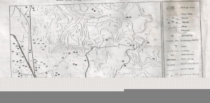 The area shown on the map is a A. Scarpland B. Ridge C. Dissected plain D. Rugged upland |
C |
| 47. |
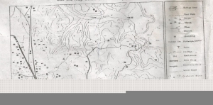 The principal functions of Ubi are most likely to be A. Religion, health care and farming B. Transportation, education and commerce C. Transportation, manufacturing and health care D. Farming, education and commerce |
B |
| 48. |
 The approximate height of the rest house north-east of Jeta is A. 30m B. 40m C. 45m D. 50m |
D |
| 49. |
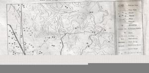 The drainage pattern of the Gindi river basin is A. Rectangular B. Radial C. Trellis D. Dendritic |
D |
| 50. |
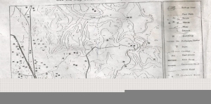 The low density of settlements in the Gindi river basin is best explained by the A. Rough topograghy B. Dense forest C. Poor transport network D. Scarcity of farmland |
C |
| 41. |
 Which of the ocean currents on the map is the Benguela Current? A. 1 B. 2 C. 3 D. 4 |
C |
| 42. |
 The shaded areas marked Y on the map are A. Salt lakes B. Major groundwater aquifers C. Oil-producing areas D. Regions of large-scale irrigation |
C |
| 43. |
 The Ahaggar plateau is the shaded area marked A. P B. Q C. R D. S |
B |
| 44. |
 The broken lines in the diagram above represent a A. River capture B. Ridge C. Watershed D. Rift valley |
C |
| 45. |
 The main work of the rivers in the shaded area is likely to be A. Terracing B. Lateral Erosion C. Deposition D. Down-cutting |
D |
| 46. |
 The area shown on the map is a A. Scarpland B. Ridge C. Dissected plain D. Rugged upland |
C |
| 47. |
 The principal functions of Ubi are most likely to be A. Religion, health care and farming B. Transportation, education and commerce C. Transportation, manufacturing and health care D. Farming, education and commerce |
B |
| 48. |
 The approximate height of the rest house north-east of Jeta is A. 30m B. 40m C. 45m D. 50m |
D |
| 49. |
 The drainage pattern of the Gindi river basin is A. Rectangular B. Radial C. Trellis D. Dendritic |
D |
| 50. |
 The low density of settlements in the Gindi river basin is best explained by the A. Rough topograghy B. Dense forest C. Poor transport network D. Scarcity of farmland |
C |